
A field guide to Barbados (Part 2): The coastal geology of southeast Barbados

Stephen K Donovan (The Netherlands) and David AT Harper (Denmark)
Introduction
This article is the second part of a field guide to Barbados, the first part of which is A field guide to Barbados (Part 1): Introduction. The areas visited by different the excursions outlined in Parts 2 to 6 of this guide are shown in Fig. 1. All itineraries commence from the Bridgetown area and the itinerary outlined in this part is rewritten after Donovan and Harper (2002). The words in italics and bold appear in the glossary at the end of the Part 1.

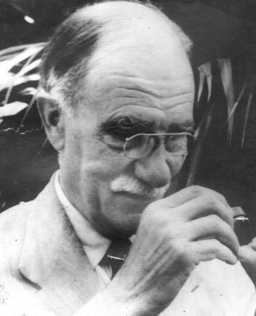
Charles Taylor Trechmann DSc, FGS (1885-1964) (Fig. 2) was an anachronism, a twentieth century gentleman geologist and archaeologist. He was an amateur with sufficient private means to dedicate his time and use his scientific abilities to make an original contribution to his chosen field of study, an original thinker with a desire to use his observations to interpret broad geological phenomena. He devoted his time to research on Malta, Gibraltar, New Zealand and, particularly, northeast England and the Caribbean. He published over 80 monographs and research papers on geology and archaeology, including at least 40 on the Caribbean (Donovan, 2003, 2008, 2010a).
Trechmann published some of the first detailed descriptions of aspects of the geology and palaeontology of many Antillean islands, including Jamaica, Barbados, Trinidad, Tobago and Carriacou. His studies of fossil molluscs are still standard references for many areas and stratigraphic units, and he was one of the leading workers on Antillean Cenozoic molluscs in the 1920s and 1930s. Trechmann’s mollusc papers have been superseded only rarely by subsequent publications. He also had the happy habit of sending important collections of non-molluscan fossils to acknowledged experts for description. He died in Barbados, on 18 February 1964, following an accident in the field, in his 79th year.
Trechmann and the geology of Barbados
Trechmann published three major papers on the geology of Barbados, which are discussed immediately below. His later contributions concerning the island relied largely on the data presented in these earlier papers.
(1) Trechmann (1925). This paper included descriptions of a large, but indifferently preserved, collection of mainly fossil molluscs made from two conglomerates, considered to be stratigraphically closely spaced, within the Scotland Beds (=basal complex; Speed, 1994). Trechmann corrected the earlier determination of a Miocene position for these beds and placed the Scotland Beds firmly in the Eocene (but see comments in Donovan, 2003, p. 349, regarding priority of Hill, 1899).
Comparisons with other Eocene faunas from the region were inconclusive (pp. 487-488), but, among others, the molluscs of the Scotland Beds were considered to have “much affinity” (p. 487) with the Lutetian to Bartonian (=Middle Eocene) interval of Europe. Trechmann considered the Scotland Beds to be “high in the Middle Eocene, or rather low in the Upper Eocene” (p. 487). A more modern estimate of the position of these beds is in broad agreement, Poole & Barker (1983) considering them to be Lower Eocene.
Trechmann (p. 487) was less accurate in his estimation of the palaeoenvironment as “… shallow water, and in some cases estuarine in origin.” The prevalence of downslope transport in generating allochthonous mixed shell assemblages in a range of tectonic settings around the Antillean islands is now widely recognised (Donovan, 2002).
The most accurate estimates of palaeodepth can only be produced where multiple lines of evidence, particularly sedimentology, ichnology and palaeontology, are integrated. Trechmann’s (p. 487) observation and interpretation that “… the only bed that yields well-preserved marine fossils, and the rolled condition of these, mixed as they are with a number of fresh- and brackish-water forms [our italics], points to the temporary invasion of the shallow water or littoral formation …” does not appear to consider the (italicised) evidence of transport to be critical. This differs from modern interpretations of a deep water origin, which recognises both turbiditic and hemipelagic sedimentary rocks in the basal complex (reviewed in Speed, 1994, p. 183). Many of Trechmann’s specimens were fragmentary and included oyster shells that may have been derived from an older unit (p. 485).
(2) Trechmann (1933). This paper represents an early discussion of his ideas on the primarily vertical nature of tectonic phenomena and uplift. It revolves around Trechmann’s theory for the uplift of Barbados, the third such theory to be formulated:
- Harrison & Jukes-Browne (1890) had proposed that each terrace of Barbados represented a period of Pleistocene reef growth, each separated by a period of tectonic uplift, the oldest reef deposits being at the highest elevation and so on. The proposed mechanism for this sequential uplift was the intrusion of an igneous laccolith (a minor intrusion with a flat floor and convex upper surface), but, as Trechmann noted (1945, p. 16), “there is no trace of igneous rocks on the island.”
- Spencer (1902) suggested that not all of the mantling limestone beds of Barbados were Pleistocene, but included Oligocene deposits analogous to the Antigua Formation of Antigua. An unconformity was suggested between the older and younger limestones. This was not supported by any palaeontological evidence (Harrison, 1907).
- Trechmann (1933) put forward the idea that the Pleistocene limestones of Barbados were originally deposited as a single isochronous sheet that had been differentially uplifted, producing a series of essentially horizontal terraces at differing elevations, but of the same (depositional) age. Uplift was considered to be oblique, produced by thrusting from the south and west, over the topographic high of the underlying Tertiary deposits. The overlying Coral Rock cracked “… along the sinuous line of the escarpment that overlooks the Scotland district [Hackleton’s Cliff] and its fragments have been sent sliding in broken fragments down the slippery slopes of the Oceanic and Scotland beds towards the sea” (p. 20). He demonstrated that the Pleistocene fossil molluscs were essentially similar at all terrace elevations, suggesting no great time differences in their deposition, although some basal deposits were thought to be, possibly, pre-Pleistocene.
Trechmann’s theory incorporated the available palaeontological evidence, based on his own field collecting, and provided an explanation for the arcuate exposure of the Scotland district. However, the advent of radiometric dating demonstrated that the core supposition of Harrison & Jukes-Browne (1890) was correct (if not the mechanism) – the highest reef terraces of Barbados are the oldest and they get younger progressively through lower elevations, spanning the last few million years or less (Mesolella et al., 1970; Bender et al., 1979; Edwards et al., 1987). Over 20 individual reefs have been identified (Speed, 1994), deposited during an extended period of progressive uplift of the island during the Pleistocene that interacted with eustatic (worldwide) oscillations of sea level. However, rather than being due to igneous intrusion, the probable mechanism for uplift is the mud diapirism of the accretionary prism that remains active today (Speed, 1994).
It is interesting to note the inversion of ideas regarding autochthonous v allochthonous successions in Barbados since Trechmann. He considered the Coral Rock to have been thrust over the underlying Tertiary sequence. That is, the allochthon (a large structural unit originating a long way from its present position) is comprised of a thrust sheet (which is similar to a nappe, but with a lower intensity of internal deformation) of isochronous Pleistocene limestone resting on the autochthon (a large structural unit originating a short distance from its present position) formed by the Scotland Beds and Oceanics. This is the reverse of what is now understood to have happened – the allochthonous Tertiary beds of the accretionary prism having formed the substrate for the growth of the autochthonous Pleistocene reefs (Speed, 1994).
(3) Trechmann (1937). This paper provided further data in support of his ideas on the formation of the Pleistocene reef terraces of Barbados. The most notable aspect of this paper is the detailed explorations of lithologies and faunas of the basal Coral Rock immediately above the unconformity with the underlying Tertiary units. Trechmann considered this fauna to have a “pre-Pleistocene aspect” (p. 358). However, there are no radiometric dates that support a Pliocene age for the basal Coral Rock (see above).
Furthermore, the lithology of the basal beds at, for example, Skeete’s Bay (Stop 2) is reminiscent of the Lower Pleistocene Manchioneal Formation of eastern Jamaica, considered to represent deep water (100m to 150m or more of water depth) fore reef deposit (Kohl, 1992). Such an interpretation is supported by aspects of the fauna not considered in detail by Trechmann, including the echinoderms and brachiopods (Donovan, 2000; Harper & Donovan, 2007). Trechmann recognised that his mollusc fauna represented a deep water association that “… may have lived at a depth of 700-1,000 feet” (p. 358; revised to “… at least 600 feet deep” in Trechmann, 1945, p. 15), but interpreted certain species, most notably certain pectinid bivalves, as representing Pliocene taxa. We suggest that these may be species that were limited to deeper water in the Pleistocene and, therefore, are relatively poorly known (or extinct?) today. They would undoubtedly benefit from detailed taxonomic revision.
Trechmann’s grave
Fig. 3 illustrates the relative positions of the localities to be visited on this excursion.

On the way to Stop 1, a detour should be taken to visit CT Trechmann’s grave to pay respect. On 20 February 1964, a death notice in the ‘Stop Press’ of The Advocate announced: “On 18th February, 1964, Dr. CHARLES TAYLOR TRECHMANN of Durham, England. The funeral will take place at Christ Church Cemetery at 4.30 p.m. today where friends are asked to meet.” Trechmann is buried in Christ Church Cemetery, not in the adjacent cemetery of Christ Church Parish Church (Fig. 4).

Stop 1: Ragged Point Lighthouse (approximately GR 59º 25′ 58″ W 13º 9′ 39″ N)
About 9.1km from Six Cross Roads, in the parish of St Philip, turn right at the ‘Lighthouse’ sign and park at end of road, but do not enter the property on the right. Although not visible from this position, this stop is close to the angular unconformity between the Scotland Beds and overlying Coral Rock. The unconformity is best seen from the impressive sea cliffs on the south side of the bay (Fig. 5).

However, first stop on this side of Spring Bay to observe the lithology of the Scotland Beds at close hand. Unfortunately, from this position, the unconformity, as such, is obscured (but see Fig. 6). If the path is not in a perilous condition, a descent to beach level in Spring Bay can be made to observe the unconformable contact (Donovan, 2010b, fig. 4).

The Scotland Beds exposed on Ragged Point range from unfossiliferous, quartzose sandstones to gritstones showing some honeycomb weathering. Massive, iron-rich carbonate(?) nodules are rare. These beds are underlain by shales (Trechmann, 1933, p. 43). Trechmann (1925, p. 486) published a measured section of the Scotland Beds at this locality, totalling about 50m in thickness, the overlying limestones varying up to a maximum of about 30m (Trechmann, 1933, p. 25). Small caves in the limestone have yielded bones of iguana and a rodent (Trechmann, 1937, pp. 357-358; Fig. 7).

The brachiopod, Tichosina inconstanta Harper & Donovan, occurs in the basal Coral Rock at this locality. This is a large, biconvex, globose terebratulide with a functional pedicle that would have lived associated with large patches of substrate. Our knowledge of both living (Asgaard & Stentoft, 1984) and Pleistocene Tichosina in the Caribbean region (Harper & Donovan, 2007) suggests an outer shelf or upper slope setting, a deduction at variance with Trechmann’s gastropod data, which suggested a shallower water origin (1933, p. 27). The Tichosina-bearing horizon is seen at beach level in the limestone cliffs on the south side of Spring Bay, west of Deebles Point.
Looking west and northwest from Ragged Point, Skeete’s Bay (Stop 2) is marked by an obvious, cream-coloured building, and Conset Point (Stop 3) forms a far headland. The differences in coastline geometry can easily be related to the presence of either Coral Rock (vertically jointed cliffs with obvious bedding) or Tertiary deposits (low cliffs and easily accessible sandy bays) (Patel, 1995).
If time is available, it is informative to visit Deebles Point, to the southeast of Ragged Point and the site from which Trechmann drew Fig. 6. The contrast in coastal morphology between the Tertiary and Quaternary deposits is even more starkly apparent from this viewpoint. Care must be taken in approaching the cliff edge, as the drop is vertical due to joint control. Walking to Deebles Point across the fields, many limestone exposures are apparent with a fauna dominated by colonial scleractinian corals. Humphrey & Matthews (1986, p. 98) discussed the sedimentation and diagenesis of the limestones of the Ragged Point area and provided a schematic diagram of the environments of deposition at Deebles Point (Fig. 8).

Stop 2: Northwest side of Skeete’s Bay (approximately 59º 27′ 00″ W 13º 10′ 00″ N)
About 3.4km from Stop 1, there is a signpost at the Skeete’s Bay turnoff. Obtain permission to park by the cream-coloured building with the green roof (EDF/Barbados Government Fisheries Building). Climb down onto the beach to the left (northwest) over the limestone armouring, then scramble over the local limestone to see the exposure.
Stop 2 is the northwest side of Skeete’s Bay, Whitehaven, in the parish of St Philip, figured and discussed briefly by Trechmann (1937), who considered it “a good collecting ground for the basal fauna” (p. 346). It is a coastal exposure of the basal Middle Coral Rock (484,000 to 127,000 years old; Poole & Barker, 1983) that rests unconformably on the Tertiary Scotland Beds and Oceanic Group (Trechmann, 1937, p. 344, text-fig. 3; Fig. 9); the basal position perhaps suggests it to be Middle Pleistocene.

The fauna includes benthic (that is, living on the sea floor) foraminifera such as Amphistegina, platy scleractinian corals, bryozoans, terebratulid brachiopods (Harper & Donovan, 2007), benthic molluscs (Trechmann, 1937), asteroids and echinoids (Donovan, 2000; Fig. 10), the traces of borings in some molluscs by the clionid sponge, Entobia isp., and scleractinians, and rarer pteropods, crab claws, and arcoscalpellid barnacle plates. The lithology, fauna and style of preservation of the fossils in the Middle Coral Rock at this locality are similar to the Lower Pleistocene Manchioneal Formation of Jamaica, deposited in a deeper water, fore reef setting.

Stop 3: Conset Point (about 59º 27′ 37″ W 13º 10′ 46″ N)
From Stop 2, take Blades Hill College Savanna no. 2 Road. The distance between Stops 2 and 3 is about 4.6km. Walk down the track towards the coast, then turn left on the coastal footpath. Veer off left into Conset’s Cutting, formerly part of the Barbados Railway. This limestone cutting is up to 3m high. Here, bedded limestones are exposed, with more massive limestones apparent further along the track (=stratigraphically lower, as bedding is dipping more or less towards south). Grainstones at the entrance to the cutting are cross-bedded on the right hand side. These limestones contain common, in situ, colonial scleractinian corals.
The limestones are finer grained and more massive lower down the section, where there are also colonial scleractinians, oysters and gastropods. Locally, there are skeletal packstones and grainstones. Stops 2 and 3 are both in the Middle Coral Rock, but there is considerable contrast in the faunas. Unlike the basal beds (=deep water) seen at Stop 2, the presence of autochthonous(?) hermatypic scleractinian corals at Stop 3 indicates that these beds were deposited within the photic zone (the zone at the surface of the ocean through which light can penetrate allowing photosynthesis) and are more similar to those seen at Deebles Point (Stop 1).
It is the basal Coral Rock at Conset Point that was proposed to be Oligocene by Spencer (1902; Harrison, 1907; Trechmann, 1933, p. 24). Although Trechmann agreed with Harrison’s assessment of the incorrectness of this determination, he did identify within this cutting three species of pectinid bivalve that he considered to be pre-Pleistocene.
Stop 4 – Hackleton’s Cliff (approximately 59º 32′ 36″ W 13º 11′ 51″ N)
Follow the road signs to the viewpoint at Hackleton’s Cliff, overlooking Bathsheba, a distance of about 11.8km. This elevated spot gives a fine view into the Scotland District, being perched near the highest point of the Upper Coral Rock and the supposed edge of Trechmann’s thrusted sheet of limestone (1933, p. 20).
Acknowledgements
Many thanks to Professor Tony Coates (formerly of the Smithsonian Institution) for discussing some of his memories of CT Trechmann at the 2002 Annual Meeting of the Geological Society of America. We also thank Mrs Betty Carillo-Shannon (Librarian, Barbados Museum) and Miss Yvonne Norville (Librarian, Barbados Advocate) for their invaluable assistance in helping us to locate Trechmann’s grave.
References
Asgaard, U. & Stentoft, N. 1984. Recent micromorphic brachiopods from Barbados: palaeoecological and evolutionary implications. Geobios Mémoire Spécial, 8: 29-37.
Bender, M.J., Fairbanks, R.G., Taylor, F.W., Matthews, R.K., Goddard, J.G. & Broecker, W.S. 1979. Uranium-series dating of the Pleistocene reef tracts of Barbados. Geological Society of America Bulletin, 90: 577-594.
Donovan, S.K. 2000. A fore-reef echinoid fauna from the Pleistocene of Barbados. Caribbean Journal of Science, 36: 314-320.
Donovan, S.K. 2002. Island shelves, downslope transport and shell assemblages. Lethaia, 35: 277.
Donovan, S.K. 2003. Charles Taylor Trechmann and the development of Caribbean geology between the wars. Proceedings of the Geologists’ Association, 114: 345-354.
Donovan, S.K. 2008. The ‘Forbidden Theory of Mountain Uplift’ of Charles Taylor Trechmann (1884-1964): a tectonic theory of the 1950s in context. Geological Journal, 43: 605-619.
Donovan, S.K. 2010a. Three points of view: Wendell P. Woodring (1891-1983), Charles A. Matley (1866-1947), Charles T. Trechmann (1884-1964), and Jamaican geology in the 1920s and 1930s. Geological Society of America Memoir, 205.
Donovan, S.K. 2010b. A field guide to Barbados: Part 1 – introduction. Deposits.
Donovan, S.K. & Harper, D.A.T. 2002. In Trechmann’s footsteps: the geology of southeast Barbados. Field Guides, 16th Caribbean Geological Conference, Barbados, June 16th-21st, 85-98.
Edwards, R.L., Chen, J.H., Ku, T.L. & Wasserburg, G. 1987. Precise timing of the last interglacial period from mass spectrometric determination of thorium 230 in corals. Science, 236: 1547-1553.
Harper, D.A.T. & Donovan, S.K. 2007. Fossil brachiopods from the Pleistocene of the Antilles. Scripta Geologica, 135: 213-239.
Harrison, J.B. 1907. The Coral-Rocks of Barbados. Quarterly Journal of the Geological Society, London, 63: 318-337.
Harrison, J.B. & Jukes-Browne, A.J. 1890. The Geology of Barbados. The Barbados Legislature, Barbados. [Not seen.]
Hill, R.T. 1899. The geology and physical geography of Jamaica: a study of a type of Antillean development. Bulletins of the Museum of Comparative Zoology, Harvard, 34: 256 pp.
Humphrey, J.D. & Matthews, K.K. 1986. The Pleistocene coral cap of Barbados. In: 11th Caribbean Geological Congress Barbados — 1986. Field Guide, Barbados, July 1986: 85-105. Government Printing Department, Bridgetown, Barbados.
Kohl, B. 1992. Pleistocene benthic foraminifera from Jamaica, West Indies. In: Studies in Benthic Foraminifera: BENTHOS ‘90: 277-288. Tokai University Press, Tokai.
Mesolella, K.J., Sealy, H.A. & Matthews, R.K. 1970. Facies geometries within Pleistocene reefs of Barbados. American Association of Petroleum Geologists Bulletin, 54: 1899-1917.
Patel, F. 1995. Coastal development and geomorphological processes: Scotland District, Barbados. In: Barker, D. & MacGregor, D.F.M. (eds), Environment and Development in the Caribbean: Geographical Perspectives: 209-232. The Press, University of the West Indies, Kingston.
Poole, E.G. & Barker, L.H. 1983. The Geology of Barbados. 1:50,000 sheet. Directorate of Overseas Surveys and Government of Barbados, St. Michael.
Speed, R.C. 1994. Barbados and the Lesser Antilles Forearc. In: Donovan, S.K. & Jackson, T.A. (eds), Caribbean Geology: An Introduction: 179-192. University of the West Indies Publishers’ Association, Kingston.
Spencer, J.W.W. 1902. On the geological and physical development of Barbados; with notes on Trinidad. Quarterly Journal of the Geological Society, London, 58: 354-367.
Trechmann, C.T. 1925. The Scotland Beds of Barbados. Geological Magazine, 62: 481-504.
Trechmann, C.T. 1933. The uplift of Barbados. Geological Magazine, 70: 19-47.
Trechmann, C.T. 1937. The base and top of the coral-rock in Barbados. Geological Magazine, 74: 337-359.
Trechmann, C.T. 1945. The West Indies and the Mountain Uplift Problem. Privately printed, Messrs. B.T. Ord Limited, West Hartlepool: 25 pp.