
Geo junkets: New Zealand, North Island (Part 1)

Jesse Garnet White (USA)

1 = Sediments (Cretaceous and Cenozoic).
2 = Greywacke (Permian and Triassic).
3 = Schist (Carboniferous to Cretaceous).
4 = Volcanic rocks (Cretaceous and Cenozoic).
5 = Sediments and ophiolites (Northland and East Coast allochthon) (Cretaceous and Oligocene).
6 = Pyroclastic rocks (Triassic and Jurassic).
7 = Limestone, clastics and volcanic rocks (Central and Eastern sedimentary zone) (Cambrian to Devonian).
8 = Granitoids (Paleozoic and Cretaceous).
9 = West Fiordland metamorphic zone (Paleozoic and Cretaceous).
10 = Ophiolites and pyroclastics (Permian).
11 = Volcanic rocks (including pyroclastics) (Permian).
12 = Mafic and ultramafic complexes (Paleozoic and Cretaceous).
13 = Greywacke (Western sedimentary zone) (Cambrian to Ordovician).
Auckland and the AVF
In a thick brain fog, crusty eyed and yawning, I sat up in bed at 4:30 am. I was in Auckland, New Zealand. It was still dark outside when I drove to Mount Eden (Maungawhau), where I hiked up a narrow dirt trail lined by tall grass stippled with dew. Coming out of the verdure, my shoes, socks and shorts were soaked through. On top of the hill, a shadow-black grouping of trees blocked the creeping morning light from behind the Hanua Ranges. The burnt orange sunrise, obstructed by cumulous, lit up like a distant mountain wildfire. Auckland city centre was under puffy, lavender-white cirrus clouds, reflecting pastel colours across the harbour. Alone in the cool and crisp pre-dawn air, I viewed the various scoria cones in the Auckland Volcanic Field (AVF) bursting through the city neighbourhoods.
Scoria is basaltic lava ejected as fragments from a volcano, typically with a frothy texture. Many cones made up of this rock have been turned into nature reserves and city parks across the city. With the exception of Rangitoto Island and Motukorea, all the volcanoes in the AVF have been modified for mining, quarrying and fortifications. In fact, Mount Eden has been adulterated numerous times for agriculture (terraced gardens), fortification, and basalt and scoria quarries.
The dormant monogenetic (that is, from single eruptions) AVF is fuelled entirely by basaltic magma (alkali basalt to nephelinite) and tephra (rock fragments and particles ejected by a volcanic eruption) from relatively shallow levels of the upper mantle. Past activity, including magmatic to phreatomagmatic strombolian and Hawaiian type eruptions, resulted in pyroclastic fall and base surges (Allen and Smith, 1994). Eruptions began at Onepoto volcano nearly 248 thousand years ago, with over half of the volcanic centres forming 40 to 20 thousand years ago (Bebbington and Cronin, 2010).
Forty-nine eruptive centres have been mapped in the AFV. The largest and youngest – Rangitoto – is the only polygenetic volcano in the system. Superb geological, stratigraphic and botanical evidence has constrained age dates for this volcano (McDougal et al., 1969). Pyroclastic deposits preserved in swamps on Motutapu Island and mainland Lake Pupuke indicate it is indeed polygenetic. Radiocarbon dating reveals eruption ages of 553 ± 7 and 504 ± 5 years BCE (Needham et al., 2011). However, according to Lindsay et al. (2011), only three volcanic centres are considered to be reliably and accurately dated (Rangitoto, 0.6 thousand years ago; Mt Wellington, 10 thousand years ago; and Three Kings, 28.5 thousand years ago).
Future large eruptions are expected in the AFV, with potentially devastating effects for Auckland and surrounding areas. A nightmarish, widespread, contemporaneous eruption would be catastrophic in its capacity for destruction. Long- and short-term eruptions could cripple the city. Numerous geohazards including lava flows, poisonous gas and ashfall would result in substantial damage to infrastructure, and cause significant business interruption and potential loss of life (Magill et al., 2005).
Five widely-separated, structurally unrelated volcanoes in the AFV are contemporaneous, highlighting both spatial and temporal differences. This is significant when considering the likelihood of the recurrence of eruptions and eruptions that are linked over time, which are key to accurate hazard assessments (Cassidy et al., 1999; Cassidy and Locke, 2010). Variations in surface expression of magmatism over time complicates long-term volcanic hazard forecasting and therefore it is unknown when or where the next eruptions will occur (Molloy and Shane, 2009).
The Karikari Peninsula
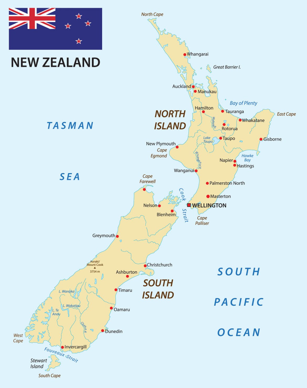
After a few days in Auckland wandering the streets, meeting folks and eating good food, I drove to the Karikari Peninsula. Due to the North Island’s geographical location in the South Pacific and proximity to the equator, northland is known as the “winterless north”. Stretching nearly 800km from Auckland to Cape Reinga, the geology and geomorphology of this long, narrow peninsula differs dramatically from coast to coast.

Offshore from west to east, Northland is encompassed by the Norfolk Rise, Norfolk Basin, Three Kings Rise and the South Fiji Basin (Eade, 1988; Mortimer et al., 1998)). The Norfolk Rise continental extensional links it to New Caledonia. The north-eastern shelf consists of large expanses of allochthonous (see below) material (Herzer et al., 2002) composed of enigmatic Cenozoic biotite schist – a medium-grade metamorphic rock composed of the mineral biotite (Mortimer et al., 2002).

Both the shelf and Vening Meinesz Fracture zone played an especially important role in the Cenozoic development of Northland (Smith and Grenfell, 2002). More specifically, important big picture events in the geological evolution of Northland include:
- Accretion of the Waipapa and Torlesse ‘greywacke basement’ terranes onto Gondwanaland (Paleozoic to Mesozoic);
- Cretaceous rifting of New Zealand from Gondwanaland (100 to 80 million years ago);
- Early Cenozoic rifting (the Challenger Rift);
- Renewed subduction and emplacement of the Northland Allochthon. (An allochthon is a large block of rock that has been moved from its original site of formation, usually by low angle thrust faulting);
- Early Miocene establishment of a northwest trending calcalkaline volcanic arc and intravolcanic Waitemata Basin;
- Subduction zone and arc migration (Coromandel volcanic arc) resulting in the Taupo Volcanic Zone; and
- The present-day fault regime (Middle Miocene to present) (Smith and Grenfell, 2002).
The five-hour drive from Auckland to the Karikari Peninsula passed through hill country superimposed by Cretaceous and Paleocene igneous rocks and Miocene basalt flows (Isaac, 1996). The surface geology continuously morphed from farmland, swamp and scrub to forest. Splendiferous beaches lining Karikari Moana, Maitai Bay and Doubtless Bay were splendidly pulchritudinous in the midday sunlight.
Near Whatuwhiwhi, I wandered through pastureland and manuka scrub to the arcing sand beaches of Karikari Moana. The view across Karikari Moana and Rangaunu Bay to Mount Camel was truly empyrean.
I drove to the beautiful arcing Maitai Bay, lined by a gorgeous sloping beach and dune fields, sheltered by hooked headlands. It is a vivid, wild and alluring, picturesque scenery. I found a private beach hideaway behind some volcanic outcrops encrusted with oysters and snails. The splash pools were filled with bright, lime-green Neptune’s necklace (Hormosira banksia), gastropods, limpets, algae and tiny translucent fish.
The Waikato Basin, Cape Reinga and kauri die back disease
I left Whatuwhiwhi at sunrise. Heading north to Cape Reinga listening to local news radio, I learned about kauri dieback disease (Beever et al., 2009). Some of the largest trees ever to have existed on the planet were relatives of modern kauri (Agathis australis) and first appeared in the Jurassic (Agathis jurassica), 150 million years ago. Fossilised remnants of Agathis jurassica are found in the Talbragar Lagerstätte northeast of Gulgong in New South Wales in Australia.
In New Zealand north of 38°S and prior to colonisation, the forest was dominated by extensive stands of ancient coniferous monoecious (that is, having both the male and female reproductive organs in the same individual) kauri, reaching heights of 50m, with trunk diameters greater than 5m. Generally found from sea-level to 600m elevation, these trees flourish in mountainous regions. The largest relatively pristine kauri forest remaining in New Zealand is within the Waipoua Forest Sanctuary and Waipoua Kauri Management and Research Area.
Deeply weathered, infertile clay soils overlie basalt in Waipoua, with kauris mainly occurring in discrete stands on relatively infertile ridgetop soils. Kauri have a unique relationship with surrounding soils and regeneration patterns. Burns and Leathwick (1996) suspect that the distribution of kauri may be the result of a feedback loop, in which acidic decomposition of kauri litter leaches poor soils further, perpetuating conifer dominance. Distribution of kauri in the Waikato Basin suggests they prefer particular soil types developed in combination with underlying geology, such as yellow-brown loams over siltstone and andesite.
There is also evidence that kauri grew on brown granular soils of Mesozoic volcanics east of Cape Runway (Creswell, 1966; Gibbs, 1980; Mitchell, 1991). Dunes of the Aupouri and Karikari Peninsulas were once dominated by kauri (40 to 20 thousand years ago) but disappeared due to soil and substrate changes, including podsolization, heavy leaching, impervious iron-pan development, and increasing bogs and swamps. Therefore, it seems that kauri prefer well-drained soils (Smith and Grenfell, 2002).
In the late 1800s and early 1900s, the kauri fossil gum (resin) mining industry, or what was then called “gumming”, was in full swing. These once abundant trees extrude a clear, transparent, solidified turpentine on all parts of the tree and into the soil in large quantities, which over time becomes fossilised in what were known as “gumfields”. It is typically light to dark brown to black and homogenous in character.
Kauri gumfields were mined from logged kauri forests, areas burned by forest fires, and also swamps and lake deposits covering buried forests. The gum, occurring as irregular lumps or successive layers, was mined from a few centimetres to over a meter in depth on dry land but mining could be as deep as three meters under swamps. Kauri gum was used primarily for the manufacture of varnishes as a substitute for copal and mastic, and for mouthpieces for pipes, cigar and cigarette holders. It was also used for carving ornaments.
Kauri are on the verge of extinction due to a number of factors including a microscopic water-borne oomycete mould (Phytophthora taxon Agathis or PTA). Commonly known as ‘kauri dieback disease’ or ‘kauri collar rot’, PTA infects tree roots and is spread easily by animals and humans to other kauri trees. There is currently no known cure (Beever et al., 2009) and only 800km2 of mixed kauri forest remain in New Zealand.
Cape Reinga (Te Rerenga Wairua) is the north-westernmost tip of the Aupouri Peninsula, at the northern end of the North Island of New Zealand, where the turbulent waters of the Tasman Sea meet the Pacific Ocean. The view of the ocean and waves crashing against the arcing Te Werahi beach and serpentinite sea cliffs are expansive and thought provoking (Figs. 3 and 4). The serpentinite soils provide a high diversity of flora, including endemic and threatened species, exhibiting dwarfism seen nowhere else in the world. These include the Dwarf Cabbage Tree (Cordyline pumilio), Dwarf Greenhood (Linguella puberula) and Dwarf Mistletoe (Kortbalsella salicornioides).
Tapotupotu Bay and other beaches, and the hole in the ozone layer
Leaving Cape Reinga, I sped to Tapotupotu Bay where the glittering waves slammed the sparkling arcing beach. There, strand lines of thousands of violet sea snails (Janthina janthina), Ram’s Horns squid (Spirula spirula), various bivalves and other shelly fauna stretched as far as I could see. Spirula spirula (Fig. 5) is a tropical cosmopolitan species. Janthina janithina (Fig. 6) is a pelagic species that secretes a bubble filled raft made of chiton to stay afloat at or near the air-water interface.


After filling my shirt pockets full of sea shells, I drove to Te Pak near Kahokawa Beach and then to Te Hapua. Across Perengarenga Harbour from Te Pak, the nearly pure silica sand deposits of the 6.5km-long Kokota Spit were blindingly white (Fig. 7). The spit nearly cuts off the harbour from the Pacific Ocean, creating a splendid estuary lined with salt marsh, mangrove and sandy-muddy intertidal flats. These are dominated by seagrass (Zostera) meadows and quartz sand near the estuary entrance. The upper estuary is dominated by mangrove forest, salt marsh and rare salt meadows. The clear, warm water – periodically influenced by eddies from the East Auckland Current – provide an unusual habitat for subtropical gastropods, including Charonia lampas among others. Many brightly coloured nudibranchs (sea slugs) dominate the substrate below low tide levels (Hayward et al., 2001).

I drove down to Rarawa Beach from Te Pak. The sunshine was brutally hot. The heat across the country during the summer is caused by reductions in ozone in the stratosphere. During September to October, the ozone hole is at a maximum and corralled by a stratospheric polar vortex. During this culmination, the country experiences no direct effects as ozone peaks in concentration. However, three distinct effects affect the country later in the season, including transitory and depletion events where:
- The ozone hole is displaced to lower latitudes before it breaks up;
- As it breaks up, remnants or filaments of ozone-depleted air pass over the country; and
- The vortex breaks up as the mass of ozone-poor air that was the Antarctic ozone hole dilutes ozone concentrations in southern mid-latitudes as it mixes (Ajtić et al., 2003; 2004).
Nearing heat stroke, I wormed my way towards Paihia and then to Tapeka Point. There were Tsunami warning signs on the side of the road and at the two beaches I could access: Tapeka Beach, a long arcing white sand beach, and Rocky Bay (Fig. 8). Rocky Bay is a volcanic pebble beach, littered with numerous gastropods, including Top snails (Ceolotrochus tiaratus), Cook’s Turban (Cookia sulcate), Mudflat Top shell (Diloma subrostratum), Cat’s Eye (Lunella smaragda) and the ubiquitous Black Nerites (Nerita melanotragus). Golden limpets (Cellana radians), a few mussels and some oyster shells were also scattered around.

Near Pakaraka, I drove towards a vegetation-covered basalt scoria cone within the Kaikohe-Bay of Islands volcanic field. The scenery was nice but the road dead-ended near Lake Owhareiti. I had hoped to get on the west side of the cone to see the lateral vent blast and subsequent lava flows but private property kept me away (Figs. 9 and 10).


The Kaikohe-Bay of Islands volcanic field
The Kaikohe-Bay of Islands volcanic field contains 30 Pleistocene to Upper Holocene eruptive centres, consisting primarily of basaltic scoria cones, lava flows and small shield volcanoes, along with minor rhyolitic lava flows and domes. The field lies at the north end of the Northland Intraplate Province. Volcanism has progressively shifted southeast over time, as younger Taheke Basalts trend northeast at the southern end of the field. The most recent eruption produced explosive activity and lava flows from four well-preserved scoria cones at Te Puke about 1,300 to 1,800 years ago. Hot springs occur at three locations, including near Lake Omapere, which was dammed by lava flows (Johnson et al., 1989).
The Kaikohe-Bay of Islands volcanic centres are mostly basaltic in character and have no obvious tectonic relationship to the subduction zone to the south. Johnson et al. (1989) consider the centres to be the result of intraplate volcanism. The chemistry of the rocks is distinct from volcanic rocks at convergent and divergent plate boundaries. Peralkaline rhyolites have been described in the Kaikohe and Pungaere areas; and non-peralkaline rhyolites have been described in the Te Pene and Hurikuri areas. There is a single date for an eruption from the Te Puke vent (400 CE) that comes from the dating of carbonised wood beneath a younger lava flow. However, scoria cones, extensive basalt flows and shields have been erupted in this area over the last ten million years.
Older cones have disappeared, with eroded remnants now forming plateaus extending from Okaihau to Kerikeri and north to Whangaroa. Deep, subtropical weathering of these has produced the rich volcanic soils that nurture Kerikeri’s orchards and crops. In the last half-million years, 12 small basalt volcanoes have erupted in the southern part of the field (Smith et al., 1986; 1993; 2002), forming a cluster of scoria cones around Kaikohe. Te Puke volcano erupted 100,000 years ago forming three small cones and lava flows. The youngest volcano is Tauanui, 10km south of Kaikohe, which erupted 60,000 years ago forming a high scoria cone and a lava flow that flowed 19km down the Taheke Valley towards the Hokianga Harbour. The field includes a small rhyolite dome (Putahi) overlooking Lake Omapere.
Nearby is the tiny village at Ngawha Springs east of Kaikohe. Hot springs in the Ngawha geothermal field are the only known high temperature system outside the Taupo Volcanic Zone, with temperatures of up to 300˚C. Current thermal activity is almost totally concentrated on a single fault at the centre of Ngawha. The system is volcanic in origin and is inferred to be a rhyolite intrusion produced by crystal fractionation of an alkali basalt magma (Cox, 1985; Cox and Browne, 1991). Controlled by hardened (by heating) Permo-Jurassic greywacke, argillite and fault zones in the Waipapa Group, waters emanate from near-surface Quaternary lake sediments and lobes of basalt lava flows. At depth, a permeable geothermal reservoir is over one kilometre thick, with waters infiltrating from the northeast and sealed by chaos-breccia.
Primary hydro-geochemical signatures include borate, chloride, bicarbonate and sulphate, with varying amounts of dissolved components. Gas volumes at the surface consist of large quantities of carbon dioxide and hydrogen sulphide from a depth of approximately 15km (Bowen et al., 1972; Cox and Brown, 1991).
And onwards…
Finally, I drove past the Waima Forest into Opononi and Omapere on Hokianga Harbour, where I walked down to the beach to view the massive Quaternary mobile dunes at Te Pouahi. These climb from west to east and plunge over the back of Rangatira Peak across manuka scrub into the harbour. Further down the road, I slipped off towards Waimamaku Beach. Tilted volcanic outcrops of early Miocene Waipoua Basalt above the Waimamaku river were visually stunning (Fig. 11).

So far, the success for the trip had been immense and I was obviously eager to experience more of this geological and scenic wonderland. To be continued …
| The parts in this series comprise: |
|---|
| Geo Junkets: New Zealand, North Island (Part 1) |
| Geo Junkets: New Zealand, North Island (Part 2) |
| Geo Junkets: New Zealand, North Island (Part 3) |
References
Ajtic, J., B.J. Connor, B.N. Lawrence, G.E. Bodeker, K.W. Hoppel, J.E. Rosenfield, and D.N. Heuff. 2004. Dilution of the Antarctic Ozone Hole into Southern Midlatitudes, 1998-2000, Journal of Geophysical Research, 109 (D17).
Ajtic, J., B.J. Connor, C.E. Randall, B.N. Lawrence, G.E. Bodeker, and D.N. Heuff, Antarctic Air over New Zealand Following Vortex Breakdown in 1998. 2003. Annales Geophysicae, V. 21, P. 2175-2183, 2003.
Allen, S.R., and I.E.M. Smith, 1994. Eruption styles and volcanic hazard in the Auckland Volcanic Field, New Zealand. Geosci. Repts. Shizoku Univ., V. 20, P. 5-14.
Beever, R.A., N.W. Waipara, T.D. Ramsfield, M.A. Dick, and I.J. Horner, 2009. Kauri (Agathis australis) under threat from Phytophthora? In E.M. Goheen and S.J. Frankel (Eds.) Proceedings of the fourth meeting of the International Union of Forest Research Organizations (IUFRO) Working Party s07.02.09: Phytophthoras in forests and natural ecosystems. Gen. Tech. Rep. PSW-GTR-221 (pp., 74-85). Albany, CA: U.S. Department of Agriculture, Forest Service, Pacific Southwest Research Station.
Beggington, M.S., and S.J. Cronin, 2011. Spatio-temporal hazard estimation in the Auckland Volcanic Field, New Zealand, with a new event-order model. Bulletin of Volcanology, V. 73, N. 1, P. 55-72.
Bowen, F.E., D.N.B. Skinner, N. Hornibrook, G.H. Scott, and A.R. Edwards. 1976. Geological interpretation of Ngawha deep drillhole, Kaikohe, Northland (N15), New Zealand. New Zealand Journal of Geology and Geophysics. V. 15, N. 1, P. 129-138.
Burns, B.R. and J. R. Leathwick. 1996. Vegetation-environment relationships at Waipoua Forest, Northland, New Zealand. New Zealand Journal of Botany V. 34, P. 79-92.
Cassidy. J., and C.A. Locke, 2010. The Auckland volcanic field, New Zealand: Geophysical evidence for structural and spatio-temporal relationships, V. 195, N 2-3, P. 127-137.
Cassidy, J., C.A. Locke, C.A. Miller, and D.J. Rout, 1999. The Auckland volcanic field, New Zealand: geophysical evidence for its eruption history. Geological Society, London, Special Publications, V. 161, N. 1, P. 1-10.
Cox, M.E. and P.R.I. Brown, 1991. Sinters and their gold contents, Ngawha geothermal field, Northland, New Zealand. Abst. Proc., ASEGIGSA Explor Sympos., Sydney, Feb., 1991, V. 30, P. 52-52.
Cresswell, R.D., 1966. Distribution of indigenous flora in the East Cape Botanical District. Historical Review, V. 14, P. 95-101.
Eade, James V. “The Norfolk Ridge system and its margins.” The ocean basins and margins. Springer US, 1988. 303-324
Herzer, R. H., B.W. Davy, N. Mortimer, and J. Mascle, 2002. Structure of the continental margin between New Zealand and the South Fiji basin. EOS Transactions, American Geophysical Union V. 83 N. 22, West Pacific Geophysics Meeting Supplement Abstract SE41D-10, p. WP92.
Isaac, M.J., 1996. Geology of the Kaitaia area. Lower Hutt: Institute of Geological & Nuclear Sciences. Institute of Geological & Nuclear Sciences 1:250,000 geological map 1 44 p. + 1 fold. Map.
Johnson R W, Knutson J, Taylor S R (eds), 1989. Intraplate Volcanism in Eastern Australia and New Zealand. Cambridge, England: Cambridge Univ Press, 408 p.
Lindsay, J.M., G.S. Leonard, E.R. Smid, and B.W. Hayward, 2011, Age of the Auckland Volcanic Field: a review of existing data, New Zealand journal of Geology and Geophysics, V. 54, N. 4, P. 379-401.
Magill, C.R., K.J. McAneney, and I.E.M. Smith, 2005. Probabilistic assessment of vent locations for the next Auckland Volcanic Field Event, Mathematical Geology, V. 37, N. 3, P. 227-242.
McDougall, I., H.A. Polach, and J.J. Stipp, 1969. Excess radiogenic argon in young subaerial basalts from the Auckland volcanic field, New Zealand. Geochimica et Cosmochimica Acta, V. 33, N. 12, P. 1485-1520.
Mitchell, N.D., 1991, The derivation of climate surfaces for New Zealand, and their application to the bioclimatic analysis of the distribution of kauri (Agathis australis). Journal of the Royal Society of New Zealand, V. 21, N. 1, P. 13-24.
Molloy, C., and P. Shane, 1999. Eruption recurrence rates in a basaltic volcanic field based on tephra layers in maar sediments: Implications for hazards in the Auckland volcanic field, V. 121, N. 11-12, P. 1666-1677.
Mortimer, N., R.H. Herzer, P.B. Gans, D.L. Parkinson, D. Seward, 1988. Basement geology from Three Kings Ridge to West Norfolk Ridge, southwest Pacific Ocean: evidence from petrology, geochemistry and isotopic dating of dredge samples. Marine Geology, V. 148, N. 3-4, P. 135-62
Mortimer, N., R.H. Herzer, N.W. Walker, A.T. Calvert, D. Seward, and C.G. Chaproniere, 2002. High T/P schist on Cavalli Seamount, SW-Pacific Ocean: A Miocene Metamorphic core complex? EOS Transactions, American Geophysical Union V. 83, N. 22, West Pacific Geophysics Meeting Supplement Abstract SE41D-11, p. WP92.
Mortimer, N., 2004. New Zealand’s Geological Foundations. Gondwana Research, V. 7, N. 1, P. 261-272.
Needham, A.J., J.M. Lindsay, I.E.M. Smith, P. Augustine, and P.A. Shane, 2011. Sequential eruption of alkaline and sub-alkaline magmas from a small monogenetic volcano in the Auckland volcanic field, V. 201, P. 1-4, P. 126-142.
Smith I E, Day R A, Ashcroft J, 1986. Volcanic associations of Northland (Tour Guide A4). New Zealand Geological Survey, 12: 5-32.
Smith, I. E. M.; Black, P. M. 1993: Chemical analyses of late Cenozoic basalts and associated volcanics from Northland. Department of Geology, University of Auckland report 5.
Smith V., and H.R. Grenfell H.R., 2002. Fieldtrip Guides, Geological Society of New Zealand Annual Conference “Northland 2002”, Geological Society of New Zealand Miscellaneous Publication112B, 116 pp.